- Home
- Districts
Singapore’s 28 districts, explained
Property in Singapore is still described by postal district. Here is what each one covers, how it is classified and what condos rent for there.
CCR Core Central Region
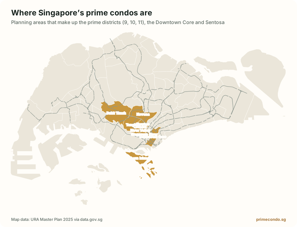
The prime districts: Orchard, Tanglin, Novena, Marina Bay and the civic core.
Raffles Place & Marina Bay
Raffles Place, Cecil, Marina, People’s Park
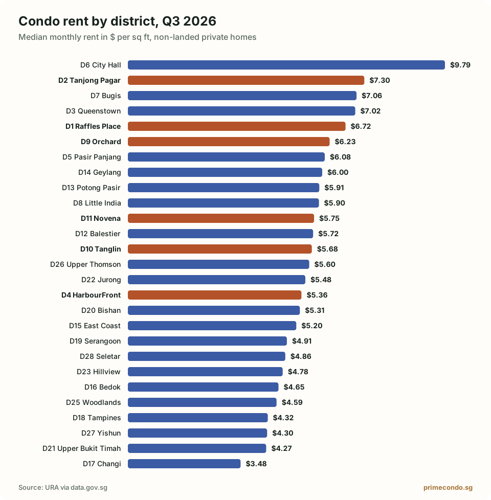
$6.72 psf median rent
Tanjong Pagar & Anson
Anson, Tanjong Pagar
$7.30 psf median rent
City Hall & High Street
High Street, Beach Road (part)
$9.79 psf median rent
Orchard & River Valley
Orchard, Cairnhill, River Valley
$6.23 psf median rent
Tanglin, Holland & Bukit Timah
Ardmore, Bukit Timah, Holland Road, Tanglin
$5.68 psf median rent
Novena & Newton
Watten Estate, Novena, Thomson
$5.75 psf median rent
RCR Rest of Central Region
The city fringe: a short commute at a discount to prime.
Queenstown & Tiong Bahru
Queenstown, Tiong Bahru
$7.02 psf median rent
HarbourFront & Sentosa
Telok Blangah, HarbourFront, Sentosa
$5.36 psf median rent
Pasir Panjang & Clementi
Pasir Panjang, Hong Leong Garden, Clementi New Town
$6.08 psf median rent
Bugis & Beach Road
Middle Road, Golden Mile
$7.06 psf median rent
Little India & Farrer Park
Little India
$5.90 psf median rent
Balestier & Toa Payoh
Balestier, Toa Payoh, Serangoon
$5.72 psf median rent
Potong Pasir & MacPherson
Macpherson, Braddell
$5.91 psf median rent
Geylang, Paya Lebar & Eunos
Geylang, Eunos
$6.00 psf median rent
East Coast, Katong & Marine Parade
Katong, Joo Chiat, Amber Road
$5.20 psf median rent
Upper Bukit Timah & Clementi Park
Upper Bukit Timah, Clementi Park, Ulu Pandan
$4.27 psf median rent
OCR Outside Central Region
The suburbs: the most space for the money, anchored by regional centres.
Bedok & Upper East Coast
Bedok, Upper East Coast, Eastwood, Kew Drive
$4.65 psf median rent
Changi & Loyang
Loyang, Changi
$3.48 psf median rent
Tampines & Pasir Ris
Tampines, Pasir Ris
$4.32 psf median rent
Serangoon, Hougang & Punggol
Serangoon Garden, Hougang, Punggol
$4.91 psf median rent
Bishan & Ang Mo Kio
Bishan, Ang Mo Kio
$5.31 psf median rent
Jurong
Jurong
$5.48 psf median rent
Hillview, Bukit Panjang & Choa Chu Kang
Hillview, Dairy Farm, Bukit Panjang, Choa Chu Kang
$4.78 psf median rent
Lim Chu Kang & Tengah
Lim Chu Kang, Tengah
No published rent data
Woodlands & Kranji
Kranji, Woodgrove
$4.59 psf median rent
Upper Thomson & Springleaf
Upper Thomson, Springleaf
$5.60 psf median rent
Yishun & Sembawang
Yishun, Sembawang
$4.30 psf median rent
Seletar & Yio Chu Kang
Seletar
$4.86 psf median rent
How Singapore’s districts work
The 28 districts come from the old postal system, where the first two digits of a postal code (the postal sector) mapped to a district. Singapore moved to six-digit postal codes in 1995, but the district numbers stuck as the property market’s shorthand.
Districts are not the same as URA planning areas such as Bishan or Tampines, and they are not the same as the CCR, RCR and OCR market segments. Groupings on this page show the segment most of each district falls in; several districts straddle two. Read CCR, RCR and OCR explained for the detail.
Median rents are for Q3 2026 and come from URA’s published rental contract data.